A team of Google employees is busy in Cambridge Bay, Nunavut as the iconic technology company attempts to build a comprehensive map of our nation’s arctic region. According to Mashable, residents of the small northern hamlet have been busy using Google’s Map Maker feature to add everything from roadways, bodies of water and communal points of interest to bring their region to life on Google Maps.
Part of the team’s mission to the great white north was to fix elements of previous maps that had been done incorrectly due to a lack of geographic knowledge. The Globe and Mail reports that a local technology expert decided to extend an invitation to the California based company after attending a Google mapping seminar in Vancouver.
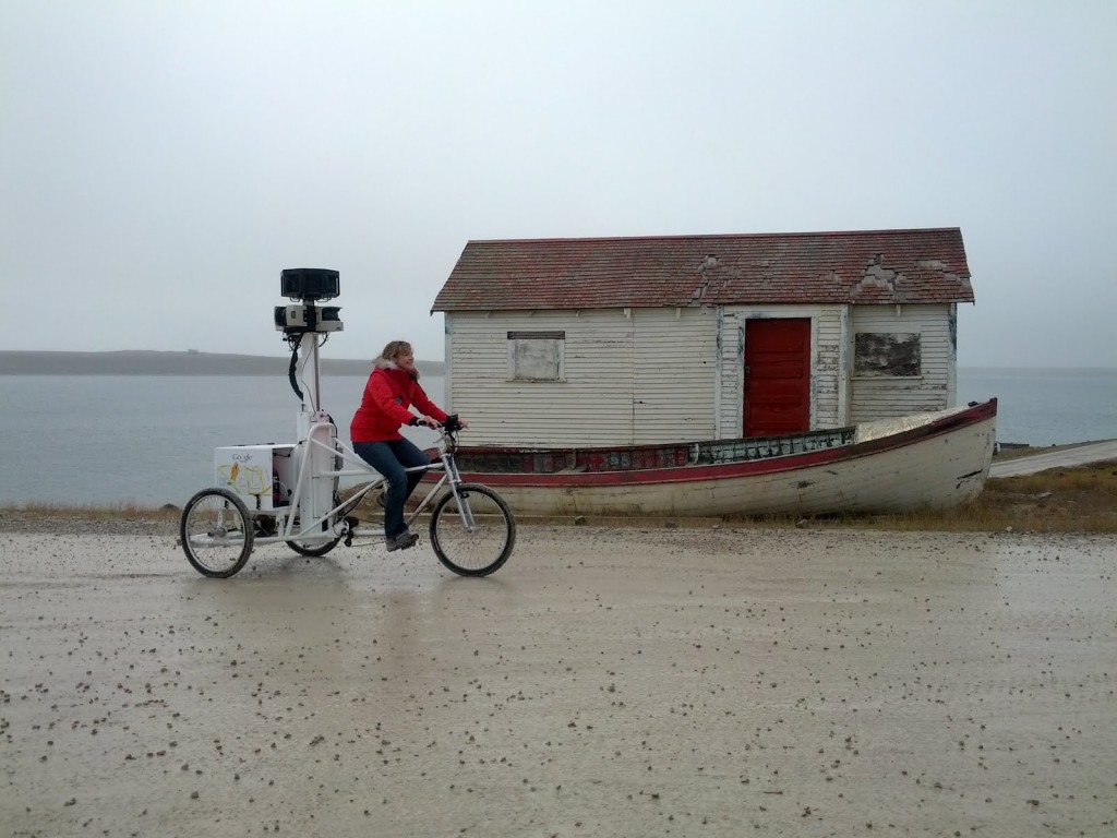
In order to canvass the area in an accurate and effective way, local residents were tasked with using specially created tricycles with attached cameras to capture the essence of the area. Cambridge Bay marks the northern most point a Google team has ever been to. This allowed the multitude of gravel roads to be traversed easily.
The iconic trip was not without some famous faces as Prime Minister Stephen Harper, he himself on a political tour took time to visit with the local teenage volunteers prior to them beginning their mapping.
Given the volatility of the elements in the Arctic, logistics proved to be a daunting task as everything had to be shipped by air and weather was anything but predictable.
It’s great to see a company as large and innovative as Google go spend some time in an incredibly peaceful and isolated place in the world. Be sure to check out Cambridge Bay on Google Maps.
 Canada Has the Worst Media Ownership Concentration of any G8 Country
 SOURCE SAYS: Upcoming BlackBerry 10 Devices Will Feature Qualcomm’s S4 Pro Chip


 Lunches So Good Kids Can’t Ignore Them
 Invigorating Ginger Smoothie
 The U.K.’s Youngest Parents Ever
 The new hair Jennifer Lawrence